Category: Wildlife and Nature


Pew Tor- an old friend

Our final walk. We returned to an old favourite, Pew Tor, just a short drive from Tavistock. It has a wonderful rock formation, remiding me of a dog’s head (see the picture above). It’s an old favourite because this walk has become bit of an institution in our family. We have done it many times with our children at various times in the past. Perhaps the most memorable occasion was when our, then young, son raced back down the slope with the call ‘running down the mountain, with some shouting!’

This slideshow requires JavaScript.

The walk today, another sunny afternoon, was easy. On previous occasions it has been a bit of a puff, but I guess our training on the previous five days was enough to make it a breeze. But this time something else was different. On previous occasions I’d looked around at the views and not known many, if any of the other tors and land in view.

But today, this felt like my space– I don’t know if it was the euphoria of having walked 20 tors in six days, or more the fact that I could look around, name the tors we could see, and more significantly, say we went there on…..

Water action has created a pool in one of the Tor's top stones

Water action has created a pool in one of the Tor’s top stones

We’ll be back- maybe for another 20 of the 160 plus tors, so that we can gradually come to know this wonderful moor even better.

Old School Gardener


WP_20140905_019

Day five on our Tor Challenge involved heading out towards Princetown once more. Our start point was a small car park near to one of the tors we would be visiting and which is also home to a tall TV mast- north Hessary. A little cloudier than previous days but still dry and warm, so it looked like it was going to be a pleasant afternoon walk. and what’s more, we were aiming to cover 6 tors, which would bring us within reach of a total of 20 for the week.

As we set off we noticed an elderly couple just heading off in the same direction as us – towards Hollow Tor, and from here to the fairly indistinct Rundlestone Tor.

Hollow Tor

Hollow Tor

From there it was short walk long a road to the TV station and tor at north Hessary, the mast of which you can see for miles around, but which despite many years visiting the area I had never got close to. The mast is an impressive, albeit man- made intrusion in the landscape. The tor itself is rather tangled with the mast and surrounding walls and fencing, but is nevertheless and distinctive shape. I also found a small plastic box containing a stamp and notebook (see picture at the head of this article), an effort by a couple of local youngsters to place a ‘post box’ for visitors to leave a message and read those put by earlier visitors. It was a modern-day example of the Dartmoor Post Boxes, I suppose an earlier form of ‘Geocaching’:

‘A small pot (the letterbox) containing a stamp and visitors’ book is hidden on the moor, and a clue is written to lead others to its position. Clues may be as simple as a map reference and list of compass bearings, or may be more cryptic.

When a letterbox is found, the letterboxer takes a copy of the stamp, as well as leaving their own personal print in the visitors’ book.

Letterboxing began on Dartmoor but is now popular in areas all over the world.’ (source: Dartmoor letterboxing.org)

Travellers from Muenster, Germany logged into the 'post box' on north Hessary

Travellers from Muenster, Germany logged into the ‘post box’ on north Hessary

Taking a bearing to our next tor, ‘Foggintor’, we set off, but a little wary, because we had a walk guide which suggested that Foggintor was in fact an old quarry and one which you come across suddenly – beware 100 foot drops! We trudged down and then up bracken-strewn valley sides, heading for a group of rocks on the horizon which the bearing suggested was our target. We reached the edge of what looked like an old quarry but somehow the map and what we saw weren’t the same; where were we?

We pressed on thinking the rocks in front were what we were looking for and then looked back – in the distance and to the left of the route we’d taken, was an obvious old quarry with some apparently deep sides. We’d obviously not been accurate in our bearings and missed the quarry (I was sort of relieved, given the look of it). This is a ‘tor no more’, as the quarrying seems to have removed all evidence of the sort of rocks or peak that we’d come to expect.

Foggintor- quarrying has removed the tor?

Foggintor- quarry has removed what was there?

 So, we were actually standing next to our fourth tor target of the walk, Swelltor, also an old quarry, but with a more discernible peak and tor like appearance.

Swelltor- more quarrying

Swelltor- more quarrying

 From here it was a simple, fairly level walk across moor to our final target of the day, King’s Tor, which had some remarkable rock piles- see the pictures below.

This slideshow requires JavaScript.

The views from King’s Tor were also good, though a mist lay over the horizon so we couldn’t see as far as had been possible earlier in the week. We looked across the valley to Yellowmeade Farm, which gave us our target for the return walk to the car. This looked to be straight, fairly short walk, but the map and walk guide advised that it would be marshy ground, so wer were prepared for wet feet! But apart from a few soggy areas, the lack of any heavy rain for a week seemed to dry out the peaty conditions underfoot, so it was more a case of hopping form grassy clump to grassy clump than wading through water!

So that was it, we got back to the car only to arrive at the exact moment the elderly coupe we’d seen early did too! They were over for the weekend from Somerset and were looking for letterboxes and had apparently found quite a few.

The day had brought 6 more tors (well nearly if you count our skirting of the tor no more) and we looked forwards to our last day, when we would climb an old favourite and bring our tally up to 20 tors.

Old School Gardener

WP_20140904_021

Day Four involved a figure of eight walk with a starting pont at the cross over of the 8. This was still a relatively short walk and would enable us to visit four tors; Leather Tor, Sharpitor, Leeden Tor and Ingra Tor. Our start point was a car park between Yelverton and Princetown, so once more we returned to southern Dartmoor.


Sharpitor

Sharpitor

We were again blessed with bright sunshine. From our start it was a bit of a puff walk up the northern slope of Sharpitor, a tor with lots of broken boulders and some interesting features.

Leather Tor

Leather Tor

From here it was a short walk across to the more impressive ‘peak’ of Leather Tor, which looked rather more like a mountain climb than was eventually required, but it was nonetheless great to clamber over rocks and stretch the tendons! After a short walk back to the car around the edge of Peek Hill, we paused for refreshments. Off again, this time we headed to the north and Leeden Tor, though our reliance on map reading and not the bearings we had planned proved to take us off the most direct route.

This slideshow requires JavaScript.

Having rechecked our bearings and double checked our map we set off for Ingra Tor, a very interesting, longish rock formation with some interesting shapes and wonderful views to the southern moor and small farms. I think this was one of my favourite tors and I took a souvenir piece of granite from it for a paperweight.

Ingra Tor - one of my favourites

Ingra Tor – one of my favourites

Four more tors completed, taking our tally to 13 for the four days. The weather was holding and it looked like we would easily exceed our challenge of climbing 10. Day five brought some interesting new angles on the tors, including one that no longer exists!

Old School Gardener

WP_20140903_018This was the big one. Day three of our Tor Challenge was billed as an all dayer, packed lunch required. Travelling to the northern edge of Dartmoor at Meldon, near Okehampton, we headed for the reservoir, a beautiful site in itself and the starting point for our day’s walk.


It was a long trudge around Longstone Hill and then across valleys and into the (today quiet) firing range, towards Black Down. From  here we followed increasingly rugged and harder-to- see paths to the foot of West Mill Tor. A short, steep ascent was rewarded with a tremendous view on another beautifully sunny day. From  here we could see our ultimate objectives- High Willhays (the highest  point in Devon and southern England) and Yes Tor, slightly lower. It was also from here that we made our first spotting of…….a nude walker! At least that’s what it looked like as a well-tanned male torso was seen stepping out boldly towards the slopes of Yes Tor. Having got over the ‘shock’ of this sight we made our way down to a wide, well trodden path that would take us up to the ridge between the two tors we were left with.

This slideshow requires JavaScript.

This was steady walking, remembering to pick up a stone or two en route to add to the cairn atop High Willhays. It was here that we saw our nude friend once more, striding out but also rather aimlessly- was he looking for someone to show off to? (we didn’t get close enough to see if he had reason to show off…). Or was he following us? He seemed to be close to our route across to Yes Tor and even waved at me and said ‘Hi’ just after I snapped a picture to prove our point….

Back to Nature- 1

Back to Nature- 1

Back to Nature- 2....

Back to Nature- 2….

After a packed lunch atop Yes Tor, admiring the distant views and chatting to fellow walkers, we saw some low clouds forming to the south and so decided to pick our way back to Black Down the quick route down the slopes, but also a rather wetter one through boggy ground. So, that’s nine Tors done, how many more could we add?

Would Day Four live up to this latest experience?

Old School Gardener

The view in the morning - looking towards Tavistock from the car park near Merrivale

The view in the morning – looking towards Tavistock from the car park near Merrivale

Having seen off the rain and mist on the first day of our ‘Tor Challenge’, we started day two with bright sunshine- you could see across the moor for miles. Today’s plan was to do two walks with a break for lunch at a well-known pub (the ‘Dartmoor Inn’ at Merrivale). The morning began with a couple of hours walk close to where we were on day one, but the contrast in weather couldn’t have been starker.

Having parked up at the pub we set off following the road back towards Tavistock and then headed inland (having taken a bearing first) ascending and crossing the rounded crest of Barn hill to the first of the targets, Feather Tor, an unassuming tor from it’s approach, but with some interesting rock formations (and a rare Dartmoor tree!).

From here it was a short, but steep walk up to a much more expansive tor, Heckwood. It affords a view that is truly breathtaking and I think this, on reflection, was one of my favourite tors on our challenge. The walk back to the pub involved finding a stream and following this past Vixen tor (which is a striking formation, but unfortunately not accessible to the public), and involved some boggy ground, but nothing too uncomfortable despite the previous day’s rain.

This slideshow requires JavaScript.

Lunch was a perfect combination of  ‘Pannini and Pint’, after which we drove to our afternoon walk- north of Tavisotck, near Lydford this time and involving one tor I’d walked a good few years back, Brat Tor with the famous stone Widgery Cross at its summit. This was quite a climb, but again, a combination of walking poles, good boots and light clothing made it only partly puffing!

The cross was erected to commemorate the Golden Jubilee of Queen Victoria in 1887. It measures 12 feet 8 inches (3.86 metres) tall and 4 feet 4 inches (1.32 metres) across the arms. The shaft is 2 feet 1 inch (0.64 metres) square and is made of 10 layers of roughly cut granite blocks, topped off with a pointed rock. The blocks are of differing sizes, which interlock with each other to make the structure more secure. It was erected at the expense of William Widgery, the well-known local artist, and bears the inscription: ‘W. Widgery, Fecit, Jubilee, V.R.’

This slideshow requires JavaScript.

From here we walked across a valley to Arms Tor (not sure if it’s called that because it has two distinctive blocks that look like arms?), which stands about 6 metres higher than Brat Tor at 457 metres.

From here, in the warm afternoon sunshine, we made our way back to the bridge and stepping stones over the River Lyd where I recorded a short video to capture the magical sound of the rippling water…..

The end of a marvellous second day and meanign we had already completed 6 tors in our Tor Challenge! Day three was to prove a bit of an eye opener in several ways…..

Old School Gardener

What a pile- some amazing granite on Great Mis tor

What a pile- some amazing granite on Great Mis tor

So, the first day of our recent ‘Tor Challenge’  began. It wasn’t promising- showers and low cloud hung over Tavistock for most of the morning and into early afternoon. But, as forecast, it lifted and was dry enough to venture out by about 4pm.

My wife had spent a lot of time researching our various walks and calculating distances, heights, grid references and bearings. we were well equipped with some new waterproofs, boots, walking pole and downloaded app for my phone (which gives a grid reference for your position and, if needed, a marker on a base map). We had looked into buying a GPS device for walking, but on balance, we felt this wouldn’t be necessary for the lengths and routes we’d gone for and with my new phone app (alongside other useful apps).

We’re not the sort of people to accept new things without question, and when it comes to clothing we’re definitely favour ‘natural’ materials over man made. However, I couldn’t resist buying a synthetic ‘base layer’ shirt in a sale we’d seen a week or two before and today was it’s first outing , under my new ‘waterproof and breathable’ jacket. I was im pressed with both, as you’ll see.

Any way, we set out for what promised to be a short walk to twowell-known tors – Great and Little Mis tors, lying just to the north-east of Princetown (of Dartmoor Prison fame) and within the Merrivale firing range (we’d checked and no firing was planned). According to Philip Henry Gosse (in his book ‘Land and Sea’, 1865), the name ‘Mis’ may derive from the tors’ druidical connections, being named after Misor the British moon goddess!

The way up- and the cloud/mist descends....

The way up- and the cloud/mist descends….

The ascent was long and reasonably steep from the car park (170 metres in fact to the summit of Great Mis tor, which is 538 metres above sea level). As we ascended we saw the low cloud covering the top of the climb and were prepared for our first taste of ‘blind walking’. We needn’t have worried. a well- worn path took us most of the way to Little Mis tor, and after a quick check on my new phone app, we knew we must have been just a few steps away from  Little Mis Tor- which we couldn’t see for all the cloud/mist. sure enough stepping out in what we thought to be the right direction, it suddenly loomed up before us- I thought it was a tree at first but it’s rocky outline was soon clear.

From here, once climbing the short route to its summit, it was short walk across open ground (following the pre-plotted bearing) to the tor’s bigger brother (or sister), Great Mis tor. this has been called ‘one of the grandest hills in Devon’ and is one of the largest tors in the southern moor, but today our view to it and form it was a complete fog, so we’ll have to return another day to appreciate the glorious view.

Great Mis Tor- the fortress looms up...

Great Mis Tor- the fortress looms up…

As we approached the tor (or so we thought) two walkers emerged from the mist walking towards us and we confirmed that we were on the right track. And a few steps further on there it was, certainly a more impressive ‘pile’ than its little sibling, and standing rather like some medieval fortress awaiting an attack- especially with its flagpole which is used to indicate if the firing raneg is beign used. We scaled it without a problem and peered around the immediate area as far as the mist would allow- not very far at all. Having climbed our first two tors, there wasn’t much else to do, so we returned.

Following my fortress analogy, coming down a different route still, at first, covered in mist and so focused on our immediate terrain (a large area of fallen granite boulders), felt rather like stepping on and over the bodies of fallen warriors, whose attack on the citadel above had obviously failed. It was eerily quiet and still with no hint of a breeze, and the clammy wetness stuck to our faces and clothes.

Reaching the bottom – and a clear sky once more- was a minor relief and boosted our confidence about our preparedness for the more challenging tors to come. A good start then. and I must say a comfortable experience too, as my new ‘base layer’ and waterproof had kept me warm and dry (inside as well as out) and my new boots were proving to be the dream footwear I had expected. We may not have given this new stuff much of a test, but it was the perfect primer for the days to come, which the weather forecast predicted would be dry, and mostly clear and warm.

The forecast turned out to be correct and the rest of our week enabled us to not only experience the climbing and walking to our tor targets for the day, but to soak up the scale and beauty of the Dartmoor landscape…as you’ll see if you join me for my next instalment of our tor challenge!

Day 2 beckons….

Old School Gardener


WP_20140903_020We’re just back from a week in Dartmoor, Devon, walking between some of the well-known, usually prominent rocky features of this beautiful landscape, known as tors

The Challenge

The tors (there are over 160 of them) are the focus of an annual event known as the Ten Tors Challenge, when around 2400 people aged between 14 and 19 (in over four hundred teams of six), face hikes of 35, 45 or 55 miles (56, 72 or 88km) visiting ten nominated tors over two days.  The teams must be self-sufficient, carrying all that they need to complete their route safely despite the terrain and the weather.  The latter can be very changeable and at times quite extreme, and success or failure can depend very much on the extent to which a team has been trained for all eventualities.

Not having completed this in her youth, my partner ( a local lass), was keen to do her own ‘Ten Tors Challenge’, but at a more leisurely pace. In the event, extremely good weather meant that we were able to visit double the target number of tors spread over six days, and including excellent overnight accommodation at my mother – in – law’s house in Tavistock! Over a series of posts in the next few days, I hope to give an interesting account of our adventures along with a few pictures. For starters here’s a ‘primer’ on Dartmoor and the tors in question….

dartmoor locationThe Moor

Covering an area of 954 sq km (368 sq miles), Dartmoor contains the largest and wildest area of open country in the south of England. By virtue of its outstanding natural beauty it is one of the National Parks of England and Wales. Unlike many National Parks in other countries, for example the USA, the National Parks in England, Wales and Scotland are not owned by the state.  The term ‘National’ means that they have been identified as being of importance to our national heritage and as such are worthy of special protection and attention.  Within each National Park there are many landowners, including public bodies and private individuals. National Parks are places where people live and work.

Geology

A large part of Dartmoor (65%) is made up of granite, an igneous rock which was intruded some 295 million years ago.  This great granite core is surrounded by sedimentary rocks including limestones, shales and sandstones belonging to the Carboniferous and Devonian periods.  Those nearest the granite intrusion were altered (metamorphosed) by intense heat and pressure and chemical reactions.

Tors

Dartmoor is known for its tors – hills topped with outcrops of bedrock, which in granite country such as this are usually rounded boulder-like formations. More than 160 of the hills of Dartmoor have the word tor in their name but quite a number do not.   However this does not appear to relate to whether or not there is an outcrop of rock on their summit.

The processes resulting in the formation of the Dartmoor tors started about 280 million years ago as the granite forming Dartmoor cooled and solidified from molten rock at a temperature of 900 – 1000˚C. The minerals which make up granite crystallised as closely interlocking grains forming the hard rock. Granite is formed of three main minerals: Quartz – appearing in the granite as translucent slightly greyish looking grains; Feldspar – white grains, sometimes stained yellowish or pink (in parts of the granite feldspar forms large white crystals); and Biotite – dark brown glistening flakes.

dartmoorVarying climatic conditions occurring over millions of years, along with the cooling of the molten and other materials were the first, mainly chemical factors in the formation of the tors. Most recently, cold conditions in the Ice Age (between 2 million to 10,000 years ago), have caused major mechanical forces to shape the landscape we see today. Of these the most important is the expansion of freezing water. The deeply weathered granite was forced apart and broken up into blocks by being subjected to frequent freezing and thawing during the cold periods of the Ice Age, and gravity was also important, moving the loose material downhill.

 The principal tors are:

Tor Height above sea level
High Willhays 621m (2,039ft)
Yes Tor 619m (2,030ft)
Great Links Tor 586m (1,924ft)
Fur Tor 572m (1,876ft)
Great Mis Tor 539m (1,768ft)
Great Staple Tor 455m (1,493ft)
Haytor 454m (1,490ft)
Hound Tor 448m (1,469ft)
Sharpitor 402m (1,320ft)
Sheeps Tor 320m (1,050ft)
Vixen Tor 320m (1,050ft)

Well that’s the basics….except you might be interested in a TV programme that is showing this evening (Tuesday 9th September) on ITV 1 (7.30pm). The first in a new series of ‘Wilderness Walks’ by bushcraft expert Ray Mears focuses on Dartmoor. I’ll certainly be watching….

…so now for an article on the first stage of our trip – and it’s a mysterious beginning to our adventure that awaits…..(I’ll explain more about the nudist along the way too).

Further Information:  Dartmoor National Park

Old School Gardener

'Wild Gardens' have a different kind of attractiveness - and value- to those that are more actively 'gardened'
‘Wild Gardens’ have a different kind of attractiveness – and value- to those that are more actively ‘gardened’

I’ve just finished reading a fascinating, beautifully written book about taking a more ecological approach to gardening: ‘Noah’s Garden’ by Sara Stein. Set in the suburbs of the USA, she describes how she ‘unbecame’ a gardener and developed her plot into somewhere that bore a closer resemblance to the native surrounding countryside. In short ‘restoring the ecology of our own back yards.’

I have her sequel, ‘Planting Noah’s Garden’ and another book called ‘Noah’s Children’ ready for my summer holiday reading! The latter is about ‘restoring the ecology of childhood’, and I’m especially looking forward to reading this because of my interest in designing and promoting ‘natural play’ spaces. Stein wrote these all about 15 years ago, but they still seem very relevant today (Stein passed away in 2005).

I’m left wondering if and how far the principles she advocates can and should be applied to somewhere like the UK. Here the climate has – at least up to now- enabled us to grow a very wide range of plants, and so has given us the chance to grow more ‘exotics’ than  many other places around the globe. Arguably this resulted in a diluting, if not replacement of a ‘native environment’ hundreds of years ago, especially from the foreign travels of the ‘plant hunters’ and the subsequent importation of exotic species, as well as the devleopment of new, hybridised forms.

I guess the principle of gardeners working with nature, acting as ‘managers of the environment’ not ‘controllers’ (or worse still, having no concern for the wider impacts of what we plant, construct or remove in our gardens), is still very valid, and we should always have regard to the impact of our planting on the wider environment – in terms of the wildlife habitats and food sources it provides, for example.

Sara Stein

Sara Stein

I was especially taken with Stein’s suggestion in the last few pages of ‘Noah’s Garden’:

‘Let’s imagine a goal: that at some time in the future, the value of a property will be perceived in part according to its value to wildlife. A property hedged with fruiting shrubs will be worth more than one bordered by Forsythia. One with dry-stone walls that provide passageways for chipmunks will be valued higher than one whose walls are cemented stone. Buyers will place a premium on lots that provide summer flowers and fall crops of seed. Perhaps there will be formal incentives; tax abatements geared to the number of native species; deductions for lots that require neither sprays nor sprinklers. A nursery colony of bats might be considered a capital improvement. There could be bonuses for birdhouses.

Oh, brave new world!’…

Well, in the UK the arrival of energy efficiency ratings for houses is perhaps a step in this direction? Maybe we should encourage ‘Garden Ratings’ too?

Old School Gardener

The English Walnut- creating a planting poser...

The English Walnut- creating a planting poser…

Whilst on holiday in Suffolk, recently, one of my friends, Richard (who lives in Bristol), posed an interesting question:

‘I have a Walnut Tree in the garden and have been trying to grow some plants in a raised area underneath it, against a wall. This area only gets early morning sun during the middle of the year. I believe that Walnuts deposit some sort of poison in the ground which affects the plants? Over 20 years I’ve managed to establish a small selection of plants through trial and error (mainly the latter); geraniums give some cover and with a ‘Chelsea Chop’ may give a second flowering, but only towards the lighter edge of the bed; Ivy seems to do well; I can squeeze out some summer colour by planting some annual begonias but these need a lot of watering. I’ve also tried several different ferns, but none have been a success to date. Any thoughts about planting the area, especially towards the back, would be welcome.’

Not having come across this issue before I did a bit of research and also sought some advice from the RHS Member’s Advice Service. There are two main species of Walnut tree; Black Walnut (Juglans nigra) – most common in North America (and native to eastern areas), and the English Walnut (Juglans regia), the type most often found in the U.K. Walnuts -especially Juglans nigra– contain a chemical called “juglone” which can be poisonous (or allelopathic) to other plants. Juglone appears to act as a respiration inhibitor which deprives sensitive plants of needed energy for metabolic activity.  For gardeners this means that many plants growing in the vicinity of a black walnut tree will either be killed or will struggle to live, with yellowing, wilting leaves.

Leaves and nuts on the Black Walnut

Leaves and nuts on the Black Walnut

Juglone is found in all parts of the black walnut tree, but it is most concentrated in the flower buds, nut hulls and roots. Unfortunately the roots of a black walnut can extend 3-4 times the diameter of the tree’s canopy, so the area affected is quite wide. Toxicity is further dependent on the soil’s texture and drainage. All walnuts – including the English Walnut- produce some juglone, as do the walnut relatives bitternut hickory, hickory, pecan and shagbark. However the amount of juglone produced is insignificant, compared to the black walnut, and the effect on other plants is minimal, if any.

Tomatoes seem to be the most sensitive to growing under black walnuts. However juglone sensitivity is also dependent on other growing conditions and what will or won’t grow under one black walnut tree may be fine under another. However, here is a compiled list of flowers and vegetables that are considered extremely sensitive to juglone.
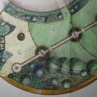
Turning back to Richard’s question, Guy Barter, Chief Horticultural Adviser at the RHS, says:

‘In theory English walnuts secret Juglone and we would advise that it is not underplanted – in any case they cast such a heavy shade that few plants will thrive underneath a walnut. Of course roots spread out beyond the canopy but interestingly we seldom encounter difficulties in the UK. All the same it may be well to avoid apples and tomatoes near a walnut tree, or at least make some experimental plantings in the first instance. In the USA the light levels are very much higher and underplanting options greater and it is not surprising that problems arise.’

Not very encouraging, eh, Richard? You seem to have had some success with plants nearer the lighter edge of his planting area, and if you want to persist with trying to plant up this and the darker inner area, you might want to start by improving the growing conditions; maybe you can prune the tree a little to raise the crown and let in more light? Having a raised bed underneath is good because you can deepen the soil above the tree roots; and maybe you can also try to replace the topsoil which could over time become affected by juglone? It might also be a good idea to add organic matter each year and at the same time remove all the walnut tree leaves and litter and dispose of these – it’s probably best to avoid composting it.

As to planting, for the inner area (assuming that you can find planting pockets large enough around any tree roots), I’d try out a few small to medium – sized shrubs and other plants that tolerate heavy shade and dryish soil – in effect trying to create an ‘understorey’ with plants of varying heights and in a combination to provide something of interest all-year round. If you go down this route then try to get healthy, well-established plants (2-3 years old and/or in 3 litre pots). As Guy suggests, you’ll have to ‘trial’ these to see if they’re up to the task! My recommended ‘planting scheme’ would include, for the darkest area (and maybe including some Ivy as ground cover):

  • Lonicera pileata– spreading evergreen shrub with small creamy flowers in spring followed by purple berries; height 60cm (2ft), spread 2.5m (8ft)
  • Hypericum calycinum (‘Rose of Sharon’) – spreading shrubs with yellow flowers from mid summer. Height 60cm (2ft), spread indefinite
  • Vinca minor (lesser periwinkle) – mat-forming shrub with trailing shoots and violet-blue flowers from mid-spring to autumn. Height 10-20cm (4-8in), spread indefinite
Lonicera pileata

Lonicera pileata

If you’d like to increase the variety of your planting around the edge (and lighter) area, you could try in addition to your geraniums:

  • Cotoneatser simonsii– deciduous or semi-evergreen with good autumn leaf colour; small pink flowers in summer followed by bright orange-red fruit. Height 2.5m (8ft), spread 2m (6½ft)
  • Mahonia aquifolium– evergreen with yellow blooms in spring. Height 90cm (3ft); spread indefinite.
  • Sarcococca hookeriana var. humilis (Christmas box)- evergreen with scented flowers in winter. Height 60cm (2ft); spread 1.2m (4ft)

…and a couple of herbaceous perennials:

  • Bergenia– evergreen leaves may colour in winter; white, pink or red flowers in spring. Height 20-45cm (8-18in), spread 45-63cm (18-25in)
  • Tellima grandiflora – semi-evergreen, with greenish white flowers from spring to mid-summer. Self-seeds freely. Height 40cm (16in), spread 25cm (10in)

Tellima grandiflora

Tellima grandiflora

…and maybe one or two patches of bulbs/tubers?

  • Anemone nemorosa– white flowers from spring to early summer. Height 7.5-15cm (3-6in), spread more than 30cm (1ft)
  • Cyclamen hederifolium– attractively marked foliage and pink to maroon flowers in autumn, seeds freely. Height 10-13cm (4-5in), spread 15cm (6in)
  • Galanthus nivalis (snowdrop) – white flowers in late winter. Height and spread 10cm (4in)
  • Iris foetidissima (stinking iris) – blue flowers in late spring and orange berries in autumn/winter. Height and spread 40cm (16in)

If this all seems rather too much hassle, then you could always cover the bed with a landscape fabric and then put a layer of aggregate or other mulch- wood bark, slate chippings etc. This covering could be punctured at intervals for clumps of bulbs (see above) to give you some (simpler) interest throughout the year- and maybe end the years of heart ache trying to get things to work that just don’t stand much of a chance!

Sources and further information:

Black walnuts at About.com

RHS guide to planting under trees

Old School Gardener

If you’ve enjoyed reading this post and others on this blog, why not comment and join others by signing up for automatic updates via email (see side bar, above right ) or through an RSS feed (see top of page)?

WP_20140807_003

Orfordness Lighthouse- Felicity, Deborah and Nick

Here’s the first article of two covering two very enjoyable days out whilst on holiday with some good friends recently.

Orford Ness is a huge shingle spit, linked to the mainland at Aldeburgh and stretching along the coast to Orford and down to North Wier Point, opposite Shingle Street. It is divided from the mainland by the river alde (Ore off Orford), and was formed by longshore drift along the coast. The material of the spit comes from places further north. Near the middle point of its length, at the foreland point or ‘Ness’, lies the Orfordness Lighhouse.

Orford Ness is an internationally important site for nature conservation. It contains a significant portion of the European reserve of vegetated shingle habitat, which is internationally scarce, highly fragile and very easily damaged.

The peninsula was formerly administered by the Ministry of Defence, which conducted secret military tests during both world wars and during the ‘Cold War’. These included bomb testing, the development of Radar and Atomic weapons testing.

We had a wonderfully sunny day for our ferry crossing and walk around the site, which shows a curious mix of natural beauty and interest with man -made stuctures and debris, much of which has been left in situ. The volunteer guides were very friendly and informative. After returning to the mainland and following a super pub lunch, we explored the river by boat and saw several groups of sea birds, including Avocet, Oyster Catcher, Tern and Sea gulls.

This slideshow requires JavaScript.

Further information:

National Trust website

Wikipedia


Finding Nature

Nature Connectedness Research Blog by Prof. Miles Richardson

Norfolk Green Care Network

Connecting People with Nature

Discover WordPress

A daily selection of the best content published on WordPress, collected for you by humans who love to read.

Susan Rushton

Celebrating gardens, photography and a creative life

Unlocking Landscapes

Writing, photography and more by Daniel Greenwood

Alphabet Ravine

Lydia Rae Bush Poetry

TIME GENTS

Australian Pub Project, Established 2013

Vanha Talo Suomi

The Journey from Finnish Rintamamiestalo to Arboretum & Gardens

Marigolds and Gin

Because even in chaos, there’s always gin and a good story …

Bits & Tidbits

RANDOM BITS & MORE TIDBITS

Rambling in the Garden

.....and nurturing my soul

The Interpretation Game

Cultural Heritage and the Digital Economy

pbmGarden

Sense of place, purpose, rejuvenation and joy

SISSINGHURST GARDEN

Notes from the Gardeners...

Deep Green Permaculture

Connecting People to Nature, Empowering People to Live Sustainably

BloominBootiful

A girl and her garden :)